Window Replacement via
3D Modelling and Laser Scanning
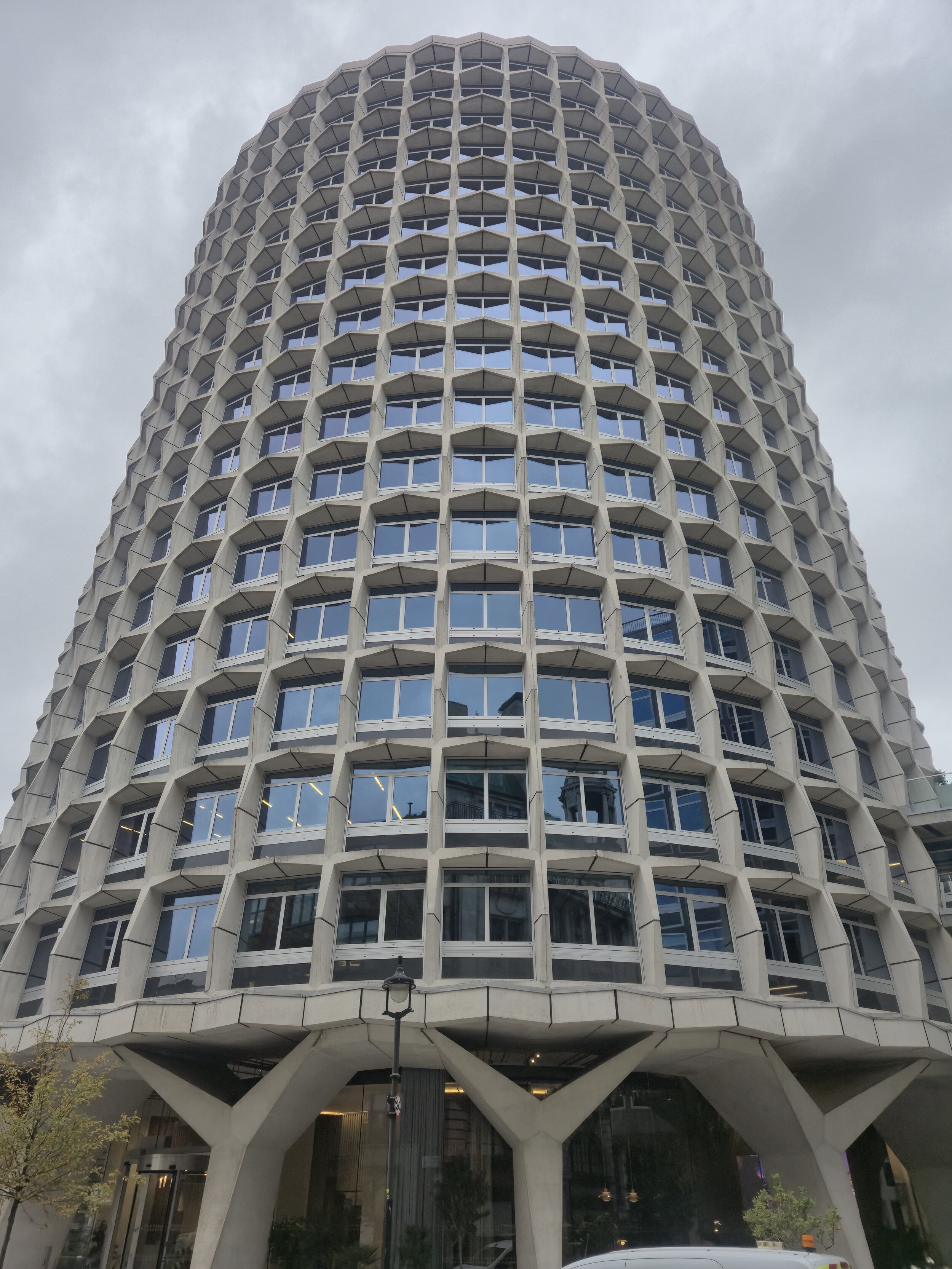
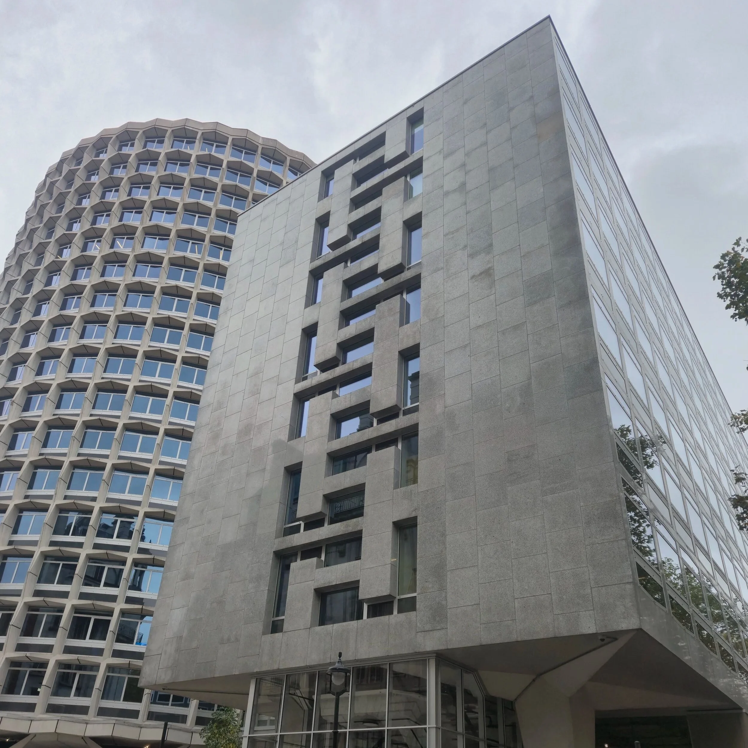
Space House, London
Laser Scanning
Site Control
3D Modelling in CAD
Services
Metra Surveying was engaged by Colorminium to deliver precise 3D drawings for the refurbishment of Space House for the installation of new windows.
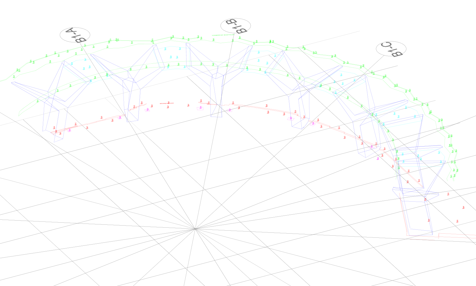
One of the primary challenges of this project was its scale and the complexity of the building's geometry. Space House is a circular structure with 16 floors, while Kingsway is a 7-story rectangular building, both connected by a bridge and featuring butterfly columns. Due to the unique shapes of these buildings, an accurate 3D model was crucial to capturing the vast and detailed data on-site.
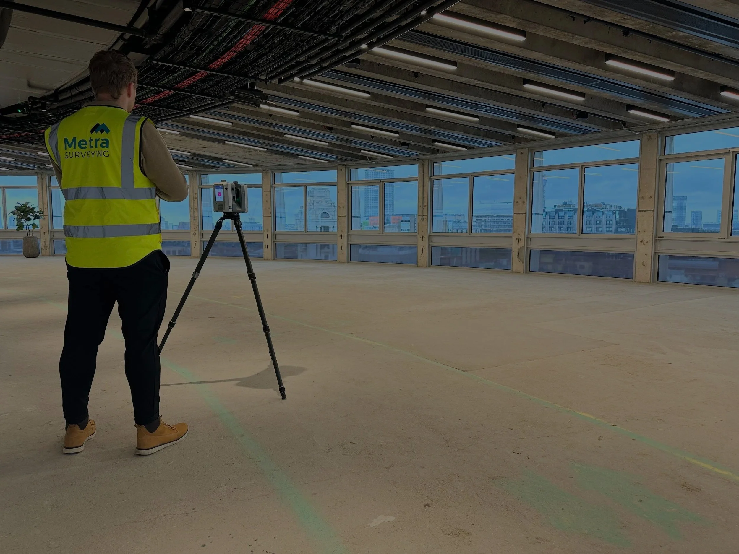
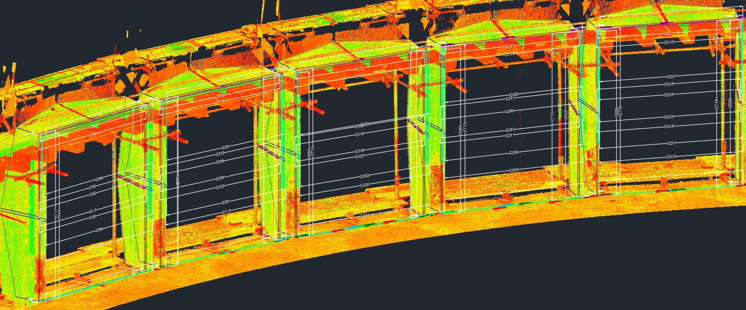
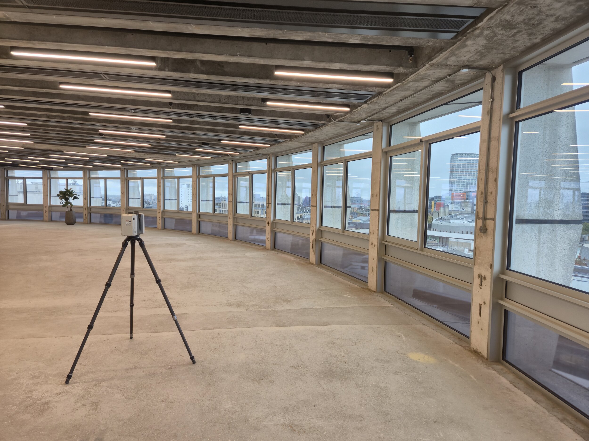
As with most refurbishment projects, the site presented some challenges in terms of clarity and access. Proper planning for site access and area clearance was essential to gather the necessary information. To efficiently capture all the required data for the 3D drawings, we utilized 3D laser scanning technology. This method allowed us to save time on-site while ensuring a comprehensive and precise representation of the existing conditions. We used Leica HDS laser scanners to collect high-quality point cloud data, which was processed floor by floor to create an accurate 3D model.
Metra surveyed both buildings in their entirety, a process that took 18 months to complete from scanning to drawing. The result was a set of highly detailed and accurate 3D drawings for each floor, enabling seamless design and construction planning.
Scope of Works
Meeting with the Client:
As with any large-scale project, the initial step involves meeting with the client to discuss the specific survey requirements and identify any potential challenges. In this instance, we held meetings at Colorminium's office prior to the project’s commencement to review the deliverables and ensure alignment on expectations. Thanks to the 3D Laser Scanner, once the first floor was scanned and modelled, the client had the opportunity to review the data, ask for further clarification, and request additional information on any areas of interest.
Establishing Control:
The workflow started with the setup of the survey control network per floor using the Leica Ts16 total station to ensure accurate positioning and to provide a reliable coordinate system for all subsequent layout, stakeout, and setout work.
3D Laser Scanning Process:
Once the control points and datums have been verified and established on-site for each level, our engineer can proceed with the 3D laser scanning process. To ensure the highest level of precision, we utilize the Leica HDS laser scanner, specifically the P40 model. The engineer is responsible for ensuring that every element, as outlined in the project requirements, is thoroughly captured by the scanner for accurate processing by our team.
3D Modelling:
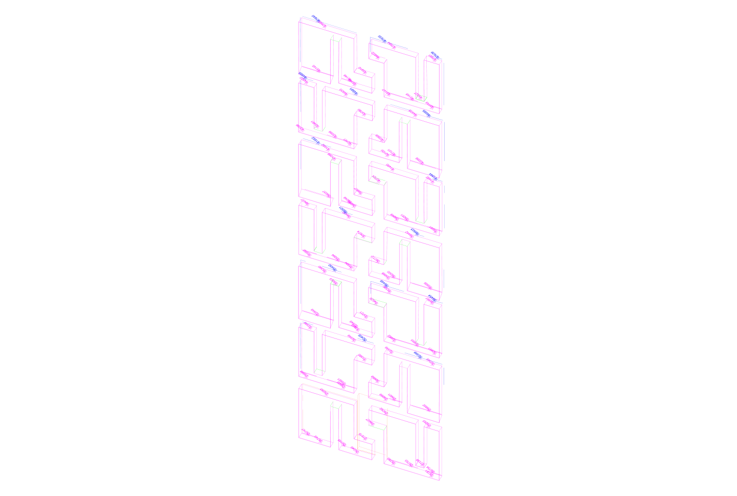
Upon completion of the scanning, the collected data is processed to generate a highly precise 3D point cloud that contains all the information gathered on-site. The CAD engineer then analyzes the point cloud, extracting the relevant details necessary for the project, ensuring that all design and construction requirements are met with accuracy. Thanks to prior meeting and agreement, the Cad engineer can now produce the drawing creating a 3D Model tailored for this project.
Results & Benefits
Exceptional Speed:
3D laser scanning significantly accelerates the process of gathering information, while also enabling us to incorporate any additional details that may be useful to the client in the future. It allows us to generate a 3D model of the structure with any level of detail required.
High Precision and Accuracy:
3D laser scanners capture millions of data points in a short amount of time, enabling highly accurate measurements of complex shapes and structures. This level of precision is essential for more intricate projects that require detailed information or involve challenging surfaces. The resulting 3D drawing had a tolerance of up to 5mm, which facilitated the design and installation of the windows by the client.
Custom-made task:
Each project is unique and comes with its own set of challenges. Therefore, it is essential to maintain clear communication and a continuous exchange of information between the client, site, and our team. This ensures that the most suitable tools and methods are selected to achieve the best results, tailored to meet the specific requirements of the project.
Non-contact technology:
Since 3D laser scanning is a non-contact technology, it can be used to safely capture data from hazardous or hard-to-reach environments, such as elevated or unstable structures, without putting personnel at risk. For a refurbishment project like Space House, which had cluttered floors and a dusty environment, the Leica 3D scanner is the ideal tool to efficiently and accurately capture the required data.
Improved Analysis:
The resulting 3D point clouds provide rich data, capturing not only dimensions but also geometric features and spatial relationships within the scanned environment. This enabled the creation of precise 3D drawings of complex elements, such as the circular layout and butterfly columns, which would have been both challenging and time-consuming to measure manually.

Conclusion
In summary, 3D laser scanning provides a faster, more accurate, and safer method for capturing detailed spatial data. This advanced technology enables the efficient collection of precise measurements, which can then be used for a wide range of applications, including analysis, design, and preservation. Its versatility makes it invaluable across numerous industries, from construction and architecture to manufacturing and heritage conservation. By offering an unprecedented level of detail and minimizing the risks associated with traditional surveying methods, 3D laser scanning is transforming the way projects are planned, executed, and maintained.